Located in the far East of Russia, the Kamchatka Peninsula is one of the most isolated and wild places in the world. Full of bears and volcanoes, an expedition to Kamchatka is a real adventure for landscape & wildlife photographers.
Kamchatka peninsula is stretching from north to south for 1,200 km. Surrounded by the Sea of Okhotsk at the west & the Bering Sea and the Pacific Ocean in the east.
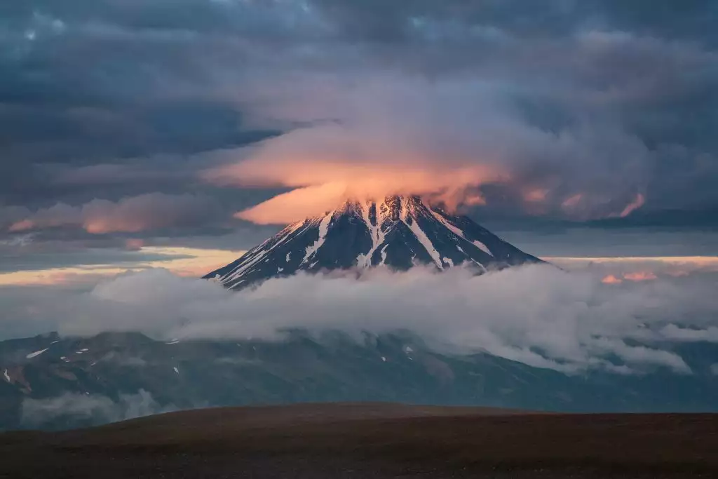
A large part of the territory of the Kamchatka peninsula is composed of natural reserves. Full of volcanoes is a perfect place for landscape photography and enjoy the local wildlife: bears and foxes. Making a photo tour to Kamchatka, a unique adventure for adventure photographers.
To know better the Kamchatka Peninsula, we will give you some curiosities about this Russian region.
The Russian Alaska
Kamchatka is one of the most untamed territories on the planet. With the nickname of the “Russian Alaska” a trip to Kamchatka is without a doubt a once in a lifetime experience where you will find spectacular volcanoes landscapes.
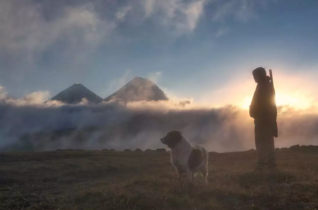
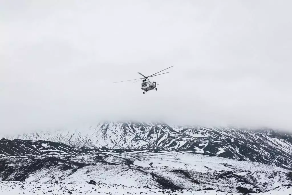
Anyway, the difference with Alaska is quite big, the roads will be opposite of the American side and you will need a soviet trucks 6×6 or even a helicopter to move around. Also, the number of visits to this region is substantially less, making a trip to Kamchatka a real adventure to the wild.
The origen of the name
The most accepted hypothesis tell that the toponym Kamchatka has its origin in the Ainu language. A native language by the original inhabitants of Southern Kamchatka, Sakhalin island, Kuril, and Japanese islands were the Ainu people’s lives. As the most toponyms in the Southern Kamchatka, Kuril Islands, and many toponyms on the Japanese islands are of Ainu origin, it seems a logical hypothesis for the name.
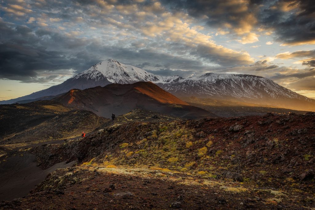
The name Kamchatka appears to be a word of Ainu origin, since in it the same component ka is found in the final position, as in the toponyms analyzed above. Apparently, the word Kamchatka consists of the following elements: kam “stretch” + cak “explode” + ka “place”, so originally the toponym probably looked like Kamcakka and meant “stretching [and] exploding terrain.”
The Kuril-Kamchatka Dialect of the Ainu Language, Alexander Akulov
The world center of volcanology
The volcanoes of Kamchatka were declared a World Heritage Site in 1996. Located in the middle of the Pacific Ring of Fire, there you can find three hundred volcanoes, of which no less than thirty are active.
It makes the Kamchatka peninsula the area with the most density of active volcanoes in the world. It’s usual that any time of the year there is a volcanic eruption and, therefore, earthquakes abound.
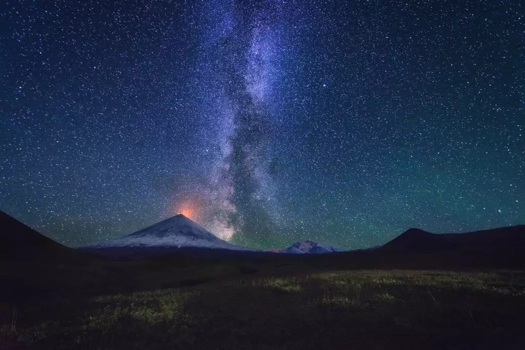
This makes sense to understand why its the world center for lovers of volcanology and scientists. Volcanoes as the Shiveluch can have a column of the smoke of more than 4,000 meters above sea level.
Climate
The climate of the Kamchatka Peninsula is severe, with prolonged, cold, and snowy winters and wet, cool summers. Most of Kamchatka’s land is tundra filled by moss and lichen, with thickets of Kamchatka alder. Sheltered lowlands, especially in the valley of the Kamchatka River, which separates the mountain chains, are in birch or larch forest, with poplar and willow in wetter areas.
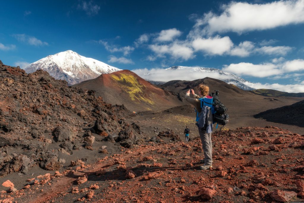
Autumn explodes in a prism of color, where vibrant hues of red and orange contrast against the earthy shades of smoking volcanoes and tundra draped hillsides. End of August & start of September generally has less rain than July (which also means few mosquitoes. Its also a prime time to observe well fed bears lounging on the riverbanks, while reindeer and mountain sheep feed in preparation for the long winter ahead.
Banned from visitors until the 1991
The leaders of the USSR (as well as now of the current Russian Federation) considered the Kamchatka Peninsula an essential strategic place. Its proximity to the United States led to the construction of multiple top-secret military infrastructures during the Cold War.
It includes a base for nuclear submarines that still remains open close in Vilyuchinsk. This way, the presence of foreigners in Kamchatka was completely prohibited until the fall of the Soviet Union.
Even today, in 2020, Vilyuchinsk, very close to the capital, is still closed to visitors. It’s not strange, that during a tour by boat around the capital to photograph the sea wildlife, you can see a submarine emerging in the water of Avacha Bay.
The wildlife of Kamchatka
The characteristics of the Kamchatka peninsula with a variety of climates and habitats, and of course the low density of humans in a such an extensive territory, make the perfect habitat for an extraordinary number of animal species.
The estimated number of brown bears, the Russian neighbors of the grizzlies in North America, exceeds 20,000 members. Its thanks to the large number of existing salmon rivers, as well as Kuril Lake, considered the most important salmon nesting site in Eurasia.
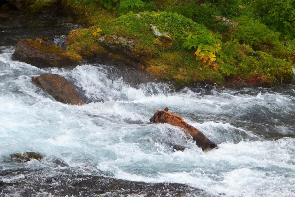
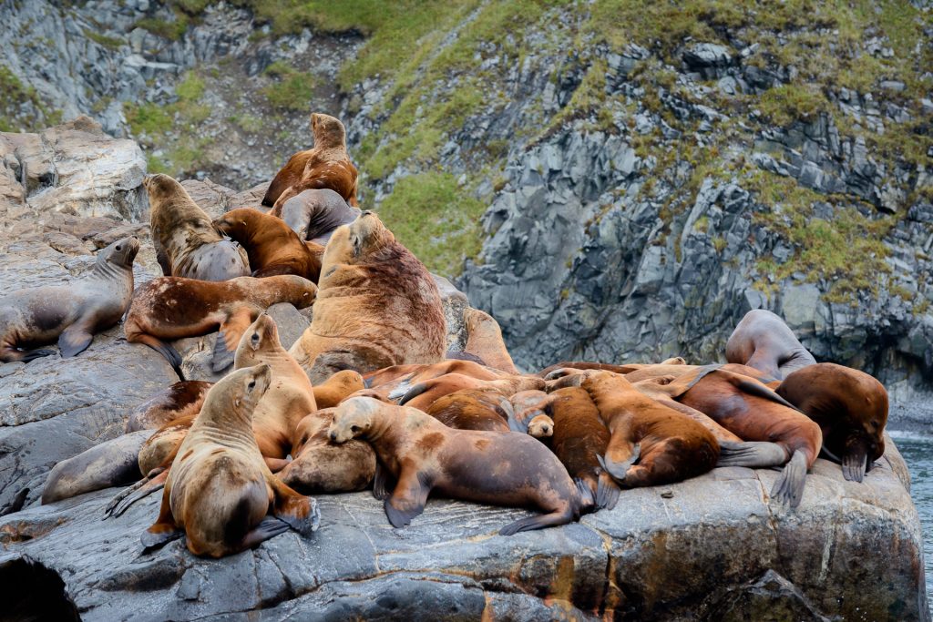
But Kamchatka it’s not famous only for bears. Here you can find also mooses, reindeers, wolves, lynx, or foxes, among many others. About sea wildlife, you can see whales, killer whales, seals, otters, and sea lions swim on the shores of Kamchatka. Also puffins fly over the peninsula every summer.
Although the highlight that many are looking for in Kamchatka in terms of birds is the giant eagle, the largest sea eagle on the planet.
Same population than Tampa, bigger than California
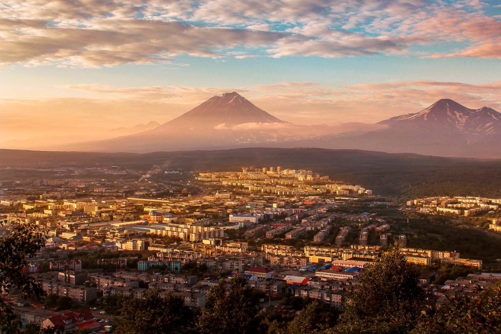
While the territory of Kamchatka can be compared to California, the population is similar to Tampa. With around 400.000 persons living in the Oblast, around 300.000 lives in the capital Petropavlovsk. There are only 2 more cities in the region: Elizovo & Vilyuchinsk, and this last as we explained remains close for visitors.
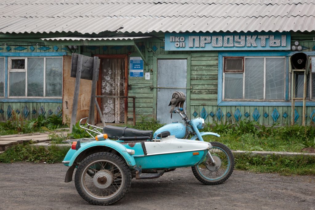
The rest of the region is only populated by small villages, farms, or settlements of reindeer herders: the Koryaks.
Kamchatka natives: Itelmens & Koryaks
The oldest residents of Kamchatka are the Itelmens, which means “those who live here”. They lived near water moving up and down the rivers, with a dugout boats made of poplar.
In the end of XVII and early XVIII centuries, Russian pioneers got into the central part of Kamchatka. This was the moment when the Itelmens start to collapse of their primitive communal relations.
Koryaks are the main population of the north Kamchatka’s. They have their own autonomy: the Koryak District. Even if they are know as the Koryaks, they do not call themselves this way.
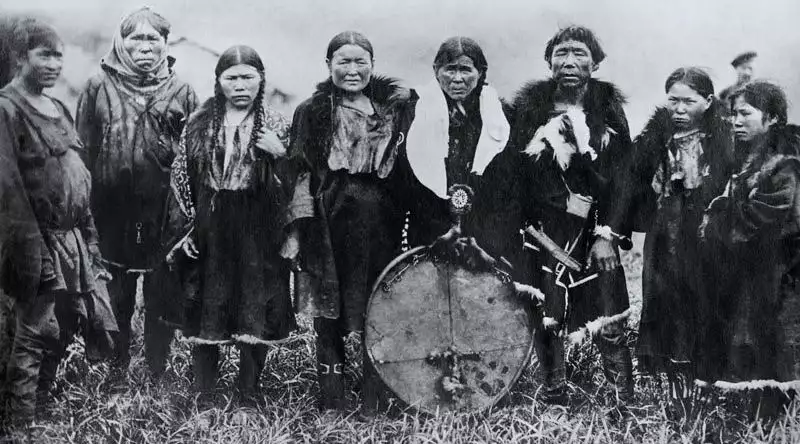
The coastal residents were called Nymylans or residents of settled villages. And the nomads, who pastured reindeer in the tundra, called themselves Chavchuvens, which means reindeer people.
The Koryaks are the ancestors of the native Americans. Its believed that they were crossing the Bering strait when was frozen. Also, the distance with the Aleutian Islands is not big, so it could be easy to navigate during summer. The similarities with the native North Americans and Canadian, so it’s easy to understand the contact between them was more usual than we can think.
Petropavlosk was founded by a danish
In 1703, the danish Vitus Bering enlisted in the Russian navy where he obtained the position of the second lieutenant of a ship. Soon he became a captain of a frigate, a distinction awarded to him for his performance in the Great Nordic War. After that, the tsar chooses him to command the first expedition that would explore the northern coasts of Asia and America.
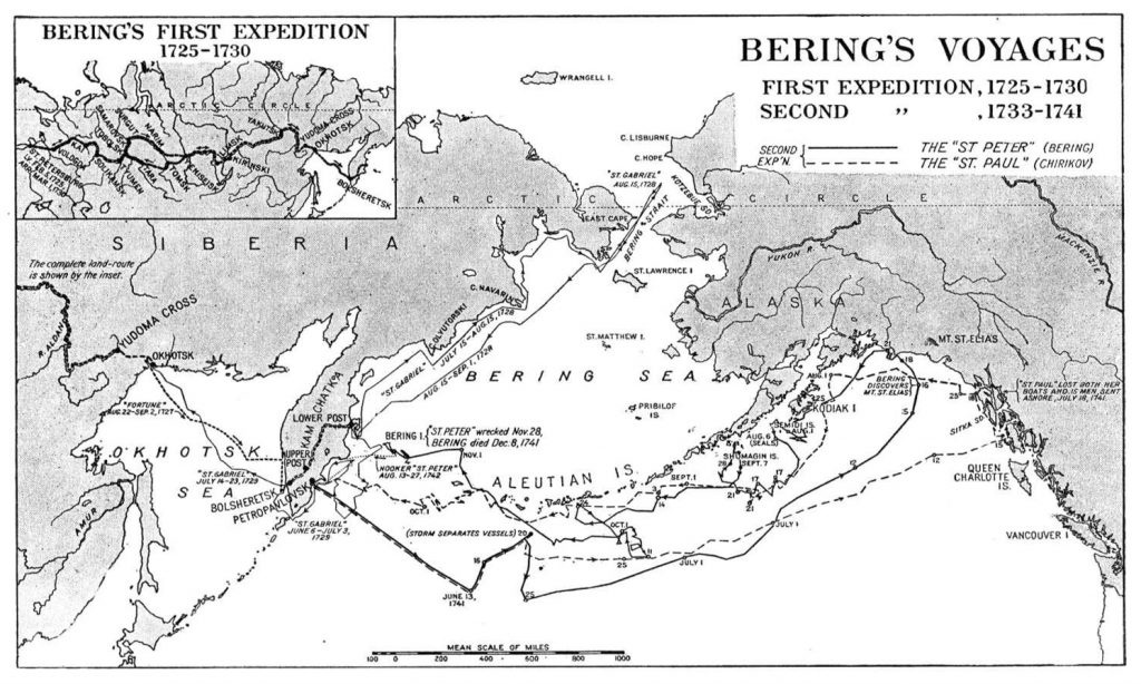
A few years later, in 1725, he is selected by Peter I to explore northeast Siberia. As a result of that first expedition, he managed to discover that Asia and America are two continents separated. In this way, the strait that separates both continents bears his name. But, when he arrived in Saint Petersburg in 1730, he was strongly criticized for not having been able to see the American coasts.
In his second expedition to Kamchatka, also called “Great Nordic”, becomes the largest scientific exploration effort to date, involving some 10,000 men. For eight years he tracked a huge area of the coasts that divide both continents, bordering Alaska and Kamchatka & founding the city of Petropavlovsk.
With the settlement of Petropavlovsk, he was able to send several ships to America and Japan in order to promote and develop Russia’s business interests in this part of the world. Then he arrives, as far as the Aleutian Islands archipelago, where his ship runs aground on an island also called Bering. On this island, the explorer died in 1741 where he fell seriously ill.
Cheap caviar
The red caviar of Kamchatka is probably the most famous exportation of this remote area. Outside of Kamchatka, it becomes a luxury out of range for most people. But here, due to its abundance, you are able to buy a kilogram for less than 50$.
Its thanks that even with a pot, in some rivers you can take it easy as in summer the keta salmon is using his waters to spawn. This way, in all travels to Kamchatka the tourists visit the market of Petropavlovsk to bring home this value product to their own homes.

GMT + 12
The region of Kamchatka is located at the start (or the bottom) of the time zone map according to GMT (Greenwich Meridian Time). Which means +12 at London time. Here in Russia, we know a lot on this subject since are no less than ten different time zones. This way you will not see a hotel, bank, or business in Kamchatka that does not have a clock showing Moscow time.
Join now our next Kamchatka Photo Tour
Now that you know more about the peninsula, we offer you a special opportunity to visit the best spots during our next Kamchatka photo expedition. Join our team of local guides, drivers, cook & photographer guides (Russian & Spanish living in Russia) in a 14 days travel with all included.
Also, we have a large variety of photo tours around Russia to discover this wild country.
Prepare your camera gear with these cameras and lenses: Nikon, Sony, Canon.

